
Sailing Brittany: North vs. South – The Ultimate Summer Cruising Guide
France’s Brittany coast (Bretagne) is a legendary sailing ground. For American sailors, it represents the Holy Grail of Atlantic cruising: massive tides, ancient granite towns, incredible food, and a maritime culture that dates back millennia. However, Brittany is effectively divided into two distinct nations when it comes to sailing: North Brittany (The English Channel side) and South Brittany (The Atlantic side). Are you looking for a rugged, rock-dodging adventure that feels like Maine on steroids? Or are you chasing turquoise waters and island hopping that rivals the Caribbean? In this comprehensive guide on Sailing Brittany North vs South, we break down the technical challenges, the landscape aesthetics, and the vibes to help you decide where to point your bow this summer.
The Big Picture: Two Coasts, Two Worlds
Before we dive into the technicalities of Sailing Brittany North vs South, let’s set the scene. Brittany is a peninsula jutting out into the Atlantic.
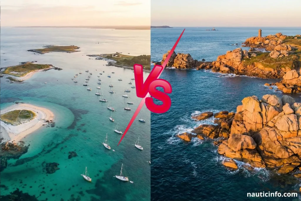
- The North (La Manche/English Channel): Runs from Mont Saint-Michel to the Ushant (Ouessant) separation zone. It is wild, tidal, and technically demanding.
- The South (Atlantic): Runs from the Raz de Sein down to the mouth of the Loire. It is generally milder, protected by chains of islands, and significantly busier.
Deciding between Sailing Brittany North vs South often comes down to your crew’s experience level and your appetite for tidal calculations.
Sailing Brittany North vs South: The “Maine” Factor (North Coast)
The North Coast is for the purist. If you love the rugged isolation of Northern Maine or the Pacific Northwest, you will feel right at home here.
1. The Landscape: Rugged and Raw
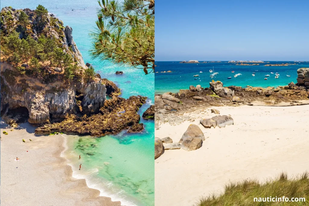
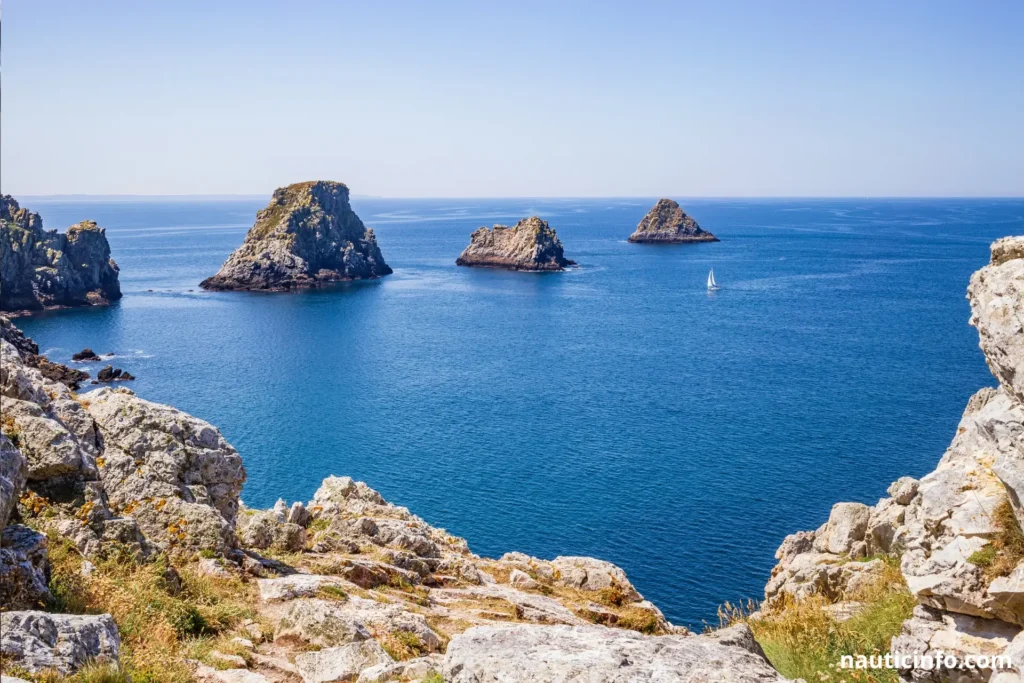
The North is defined by pink granite rocks, towering cliffs, and medieval fortresses. The coastline is jagged. Consequently, the approach to harbors often feels like navigating a maze. The beauty here is dramatic and imposing.
- Highlight: The Côte de Granit Rose (Pink Granite Coast) is visually stunning.
- Key Ports: Saint-Malo (a pirate city walled in by stone), Roscoff, and Paimpol.
2. Navigation Difficulty: High (Double Black Diamond)
Make no mistake; this is challenging water. The North Coast experiences some of the highest tidal ranges in the world—up to 40 feet during spring tides.
- Currents: You can expect currents hitting 5 to 8 knots in places like the Héaux de Bréhat. If you fight the tide, you go backward.
- Access: Many harbors are “tidal,” meaning they dry out completely at low tide. Unless your boat has a lifting keel or legs, or the marina has a sill (a wall to keep water in), you are restricted on when you can enter and exit.
3. The Vibe
It is quieter. You won’t find party boats here. You will find serious sailors, empty horizons, and a sense of accomplishment after every passage.
Sailing Brittany North vs South: The “Cape Cod” Factor (South Coast)
If the North is Maine, the South is Cape Cod meets the Caribbean. It is the heart of the French sailing industry (home to Beneteau and Fountaine Pajot).
1. The Landscape: Islands and Beaches
The South is famous for its “micro-climate.” It is sunnier, warmer, and greener. The coast is protected by a string of islands (Groix, Belle-Île, Houat, Hoëdic), which break the Atlantic swell.
- Highlight: The Glénan Islands. Often called the “Breton Tahiti,” the water here is crystal clear turquoise.
- Key Ports: La Trinité-sur-Mer (the Mecca of racing trimarans), Le Crouesty, Concarneau.
2. Navigation Difficulty: Moderate
While you still have tides (roughly 10 to 15 feet), they are much more manageable than the North.
- Currents: Generally weaker, except in specific “bottlenecks” like the entrance to the Gulf of Morbihan, where the current can still rip at 9 knots.
- Access: Most major marinas are deep-water accessible 24/7. You have more freedom to move without consulting the tide tables every 15 minutes.
3. The Vibe
It is lively. The South is where the French go on vacation. The anchorages can get crowded in July and August. However, the atmosphere is festive, the seafood restaurants are bustling, and the sailing is relaxed.
Technical Showdown: Tides and Currents
To truly understand the difference when Sailing Brittany North vs South, we need to look at the numbers.
The Tidal Gate Concept
In the North, you are ruled by “Tidal Gates.”
- Scenario: You want to enter the port of Saint-Malo.
- The Reality: The marina is behind a lock. You can only enter 2 hours before high tide and 2 hours after. Miss that window? You are anchoring outside in the swell for 8 hours.
In contrast, in the South (e.g., La Trinité), you sail in, dock up, and grab a beer.
Sailing Brittany North vs South: Practical Tips for US Sailors
Whether you choose Sailing Brittany North vs South, keep these US-centric tips in mind:
- The Language Barrier: In the South, English is widely spoken in marinas. In the North, particularly in smaller fishing ports, a little French goes a long way.
- The Metric System: Your chart plotter might be in feet, but the locals speak meters. Quick Hack: 1 Meter ≈ 3.3 Feet. If a chart says “Depth 2m,” you have roughly 6.5 feet.
- The Food:
- North: Oysters (Cancale) and heavy butter pastries (Kouign-Amann).
- South: Langoustines, Sardines, and crisp Muscadet wine.
- Weather Gear:
- North: Bring heavy foulies. Even in August, it can be cool and damp.
- South: Shorts and t-shirts during the day, a fleece for the evening.
Sailing Brittany North vs South – Comparative Table: North vs. South
To simplify your decision on Sailing Brittany North vs South, here is the breakdown:
| Feature | North Brittany (La Manche) | South Brittany (Atlantic) |
| Primary Vibe | Adventure, Solitude, Rugged | Vacation, Social, Relaxed |
| Tidal Range | Extreme (up to 40 ft) | Moderate (10-15 ft) |
| Navigation Level | Advanced / Expert | Intermediate |
| Marinas | Often gated/tidal (restricted hours) | mostly Deep water (24/7 access) |
| Crowds | Low | High (esp. August) |
| Scenery | Pink Granite, Cliffs | White Sand, Pine Trees |
| Best For | Purists & Adventure Seekers | Families & Cruisers |
Suggested Itineraries
The North Route: “The Corsair’s Trail”
- Duration: 1 Week
- Start: Saint-Malo
- Stops: Saint-Cast, Paimpol, Bréhat Archipelago, Perros-Guirec.
- Why: You sail through the strongest currents in Europe and see the most dramatic rocks. The history in Saint-Malo is unbeatable.
The South Route: “The Island Hopper”
- Duration: 1 Week
- Start: La Trinité-sur-Mer
- Stops: Houat Island, Hoëdic Island, Belle-Île (Sauzon harbor), Gulf of Morbihan.
- Why: Short sailing legs (10-15 miles), stunning anchorages, and excellent dining on shore. It is stress-free sailing.
Sailing Brittany North vs South – Conclusion: Which Zone Wins?
So, in the battle of Sailing Brittany North vs South, who takes the crown?
If you want to return home with stories of battling 8-knot currents, dodging rocks, and seeing a landscape that looks like Game of Thrones, choose the North. It is a sailor’s sailing ground.
However, if your goal is a relaxing vacation with the family, where the sailing is pleasurable rather than a mathematical equation, and you want to swim off the back of the boat, choose the South.
Our Verdict: For a first-time American skipper in France, start with the South. You get the culture and the beauty without the stress of a 40-foot tide. Once you’ve mastered the charts and the cider, head North for the ultimate